![]() Voluntary citizens' group
Voluntary citizens' group
"I mati dela Sorna" of Brentonico
No address or telephone number
Please refer to the author
(logo by Aldo Ripamonti)
![]() Voluntary citizens' group
Voluntary citizens' group
"I mati dela Sorna" of Brentonico
No address or telephone number
Please refer to the author
(logo by Aldo Ripamonti)
The Monte Baldo Highway 10,000 B.C. Many scholars, first perhaps Brentari, followed by Dal Ri, Tomazzoni, Chiocchetti and Chiusole, to mention those I remember, had advanced the hypothesis that the Baldo route had been the route of man's penetration into the Alpine area, since the Adige valley where thawing waters flowed, was marshy, impassable and scarcely frequented by herbivores, and the sheer cliffs over Lake Garda impeded passage. Now Domenico Nisi and Bernardino Bagolini, after walking and retracing the slopes of Baldo for years, have managed to reconstruct the track, which they call the 'highway of prehistory', trodden for millennia by men in the Stone Age (Palaeolithic period) and which in the age of polished stone (Neolithic period), stayed on our territory, living in huts, breeding dogs, horses cattle and sheep and started the first crops; while others of their kind continued and populated the Alpine area. They were Iberians and Ligurians, peoples of Mediterranean origin, perhaps of Semitic race, who arrived in remote ages, first in Spain and then in Italy from North Africa. Finds from the Palaeolithic and Neolithic periods were found everywhere on Monte Baldo and bear witness to these early inhabitants. Evidence of this are the flints found on the southern slope of Mount Baldo and up to the 2000 metres of Punta Telegrafo, but more convincing for us are the finds from Malga Tretto, of S. Valentino, of Malga Campo, of Pian di Festa. of Tragno, of Sorne and of Brentonico itself.
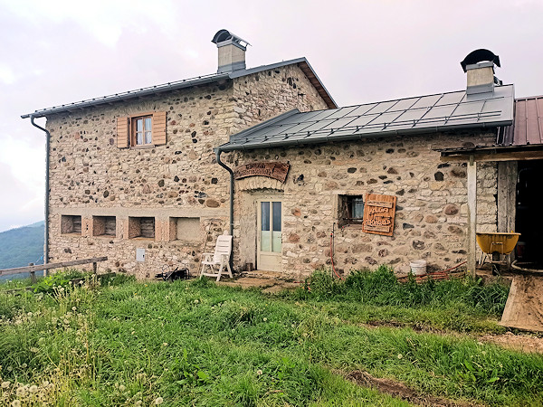
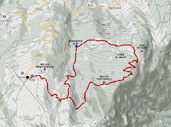
The Malga Montagnola is still active
From the car park of the pizzeria, take the road towards cima Vignola, after about ten minutes' walk you will come to a crossroads and take a left onto Strada Cestarelli, which is closed off by a bar. In season (June-September) there are many grazing cows, we recommend to close the bar tightly to prevent the cows from walking all the way to Polsa. Proceed along the flat Cestarelli Road until the a distance of 1.7 km from the Polsa, and here descend to the left on a barely marked forest road (GPS point 45.775427, 10.957174). You descend along a grassy ridge for about 60 metres until you come to the Strada Montagnola bassa, which you follow to the left until shortly reach the centre of a small valley where a downhill forest road branches off to the right. Follow the road for about 50 metres of drop until you meet a path to the right that turns into a road as soon as you reach Pozza Ciocca, where you easily cross the Rio la Lasta. Follow the road slightly downhill for about 500 metres to the GPS point 45.784003, 10.959726 and here leave the road and follow a path that branches off to the left.
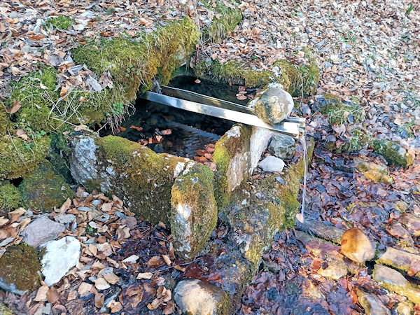
The ancient Albi spring where people and animals have watered for centuries
You descend a steep path, sunk into the ground: in dialect, this type of path is called 'sdroz'; this was the route used
by our ancestors to bring home the strings of wood loaded onto sledges called 'barusole' and pulled by donkeys or oxen. At the end of the
descent, we finally reach the Albi spring, which exists in living memory. The locals say that this is the purest and best spring in the world.
In fact, the water is present and very fresh even in the height of summer and during droughts, which means that it comes from deep within the
bowels of the earth.
Take an easy flat road to the right that soon leads to Localita' Bortolasi where the first houses are located: these are ancient 'baiti',
renovated and used for holidays by the inhabitants of Saccone. Proceed along the same road until you cross the road, in cement paved road
that climbs from the village of Saccone; a steep climb leads to a plateau where, on the left, a house can be seen adjacent to the road.
The ancient dwellings on the slopes of Monte Baldo
A dirt road climbs to the right and in about 10 minutes leads to the Prai magri locality in the presence of the famous 'stol' described by Luigi Zenatti as one of the first 'houses' in Saccone. Without the GPS point 45.784346, 10.970119 it is almost impossible to find the precise location. In case these diversions does not interest you, you proceed on a level road and a subsequent climb leads to the Bracon area. You pass in the vicinity of a small hill called 'Dos rotont' where numerous vestiges of the First World War are still present (see the BRACON route). At a crossroads with signs, continue straight on towards the Vignola peak and after numerous uphill hairpin bends you reach a flat meadow. At the signs, turn right towards Polsa and you will soon reach the poor remains of Malga Cestarelli, which is also difficult to find without a GPS point (45.778526, 10.968728). Proceed up and down the Malga Cestarelli road until you again meet the stanga open at the start and until reaching the Polsa again.
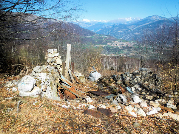
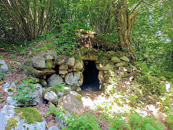
The poor remains of Malga Cestarelli, a wonderful panorama of the Adige Valley
WARNING - The group of volunteer citizens called 'I mati dela Sorna' has worked hard to make the trek as safe as possible. Keep in mind that Monte Baldo is still a mountain and, as with all excursions in an alpine environment, it is not absolute safety cannot be guaranteed.
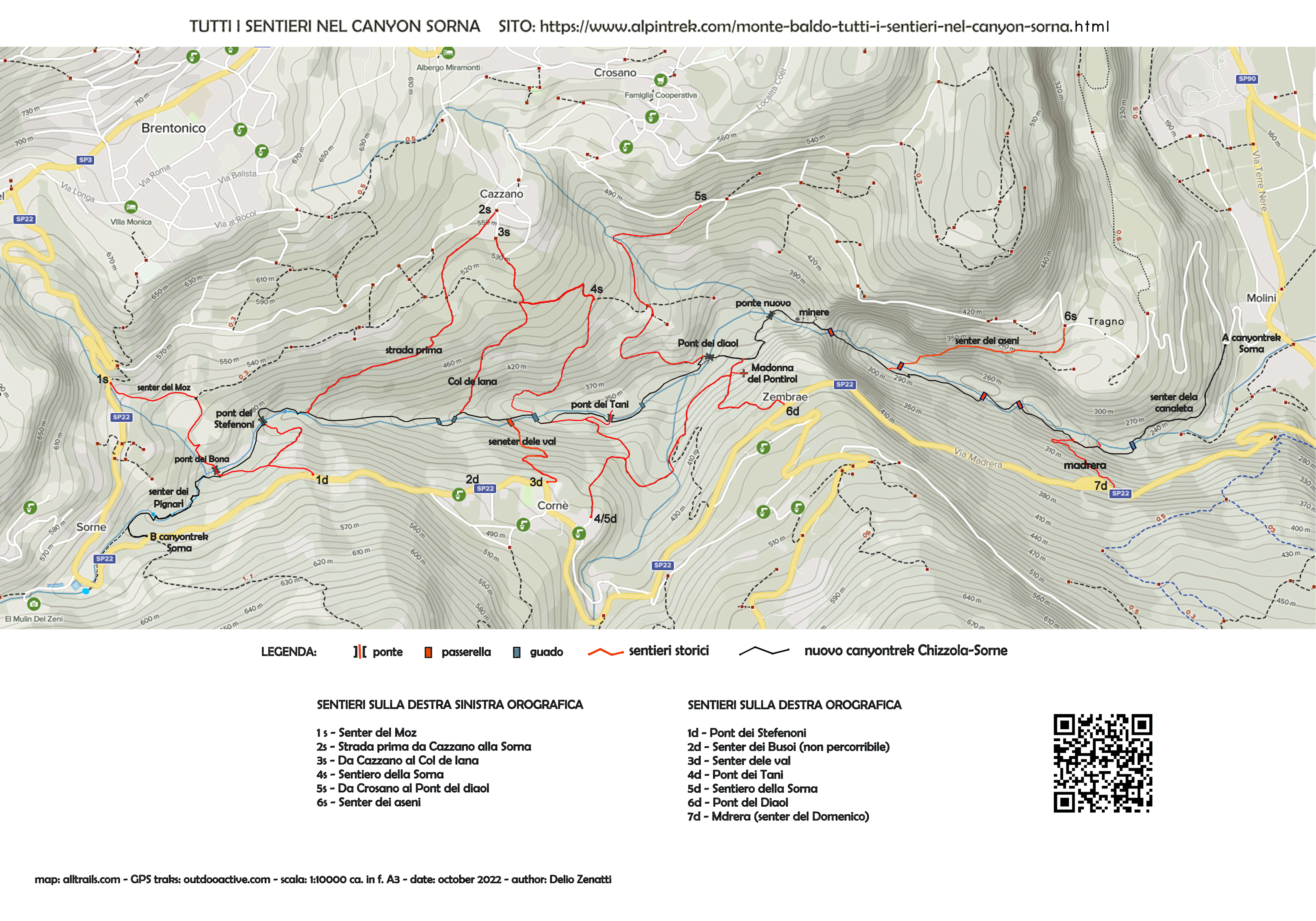
MONTE BALDO TUTTI I SENTIERI NEL CANYON SORNA - MAP CANYONTREK SORNA
UNKNOWN PATS ON MONTE BALDO - SENTIERI SCONOSCIUTI SUL MONTE BALDO
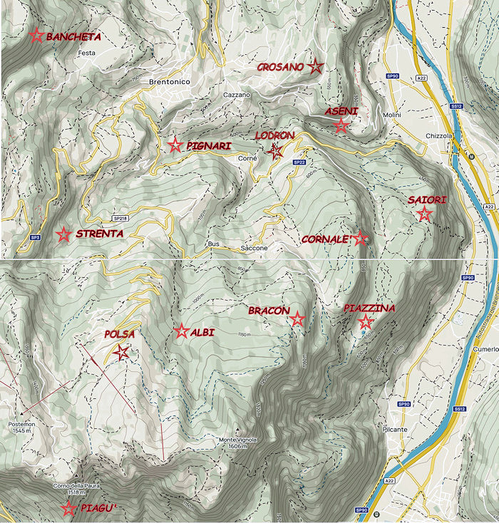
CORNALE' - BANCHETA - PIGNARI - BRACON - ASENI - SAIORI - PIAGU' - PIAZZINA - ALBI - CROSANO - POLSA . LODRON
SOURCES - From outdooractive.com, you can also download the gpx file of the route.
Web site https://out.ac/IKdxMn
Alltrails.com maps - Delio Zenatti's gps tracks on outdooractive.com